Law Enforcement Gets the Decision Advantage with Affordable Next Generation GIS Apps
No technology has given us such a literal insight into the world around us than satellite imagery – from our everyday use of Google Maps to more serious applications in the local and national security community.
This top down view of the world, combined with actionable data about the terrain, buildings and even persons on the ground, has transformed how emergency responders, law enforcement officials, and others in the security arena act on intelligence, plan and prepare for potential scenarios and adjust tactics from the field.
However – traditional geospatial imagery and information has its limits. Say, for example you are a law enforcement official in Arlington, Virginia. While your geospatial app can give you a great view of the roof of a potential suspect’s apartment block, and probably also tell you which apartment your suspect lives in. What if you could use the power of multiple, yet integrated viewpoints, to measure the perimeter of the block, gauge the best surveillance points based on a clear line of sight, plan ingress and egress points, and share this information in pre-raid briefings. Imagine the time saved during the initial “Time on Target”?
Even better, as the mission is refined, what if other users could input their findings to improve unit coordination, all in a single field-friendly workspace?
This is the power of “Intelligence on Demand” a new powerful web portal from Lockheed Martin which we introduced to [acronym] readers in last month’s post: “Putting Virtual “Boots on the Ground” – Law Enforcement Gets Intelligence on Demand”.
This ability to essentially “know before you go” is groundbreaking for law enforcement officials, because the Intelligence on Demand (IoD) tool is offered as a Web-based, low-cost cloud computing solution that can be accessed from anywhere – in HQ and via mobile devices in the field. It also supports many phases of an operation, from the initial planning through grand jury presentation and ultimately through prosecution
Law Enforcement and IoD at Work
Read last month’s article for more insight into how IoD works. But how is it used in practice?
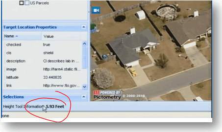
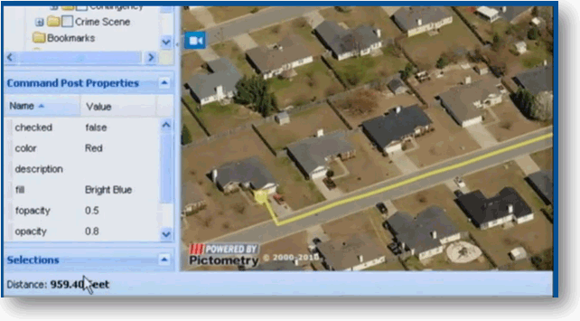
Well, say a law enforcement team is investigating a suspected drug lab in a suburban neighborhood. Officers can use IoD to conduct a preliminary site assessment of the target location and start identifying and annotating location features, areas of concern and areas requiring additional research. In the examples below, the height tool lets this officer gauge the height of the surrounding fences and assess the distance from the team staging area to the target.


 This is just one example of how the tool supports preliminary surveillance, helping officers to develop mission plans that can be shared with the entire strike team. While it’s not intended to replace on-the-ground surveillance, IoD certainly enhances the decision advantage for law enforcement operations.
IoD users can build individual mission workspaces and share them with other IoD users as required. This sharing can be done internally as well as across domains (e.g. between law enforcement agencies). There are no restrictions on the sharing and dissemination of IoD workspaces among law enforcement partners, fire and rescue, and support services.
The strong audit trail that IoD leaves also means that it can support prosecution efforts and convey the characteristics of a target and how operations were conducted to jurors and others.
This is just one of the applications of IoD, it also supports border protection and threat assessment, emergency response and environmental and land management programs.
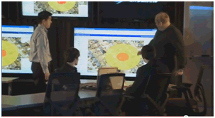
Lots to chew on! This YouTube video gives a better sense of the true capabilities of IoD, take a look.


