LiDAR Reveals Hidden Mayan “Megalopolis” Blowing Minds and Old-School Thinking

Archeological surveys in untouched areas are tricky at the best of times. Vegetation and trees must be disturbed, heavy equipment is brought in, and the results can still prove inconclusive or fruitless.
But thanks to laser technology, that’s all changing. LiDAR (aka Light Detection and Ranging technology) is helping archeologists champion scientific research without disturbing the natural habitat.
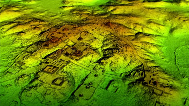
In what’s being hailed as a major breakthrough in archeology, researchers have uncovered a vast hidden metropolis in the jungles of northern Guatemala using LiDAR. The ruins contain a staggering 60,000 houses, palaces, elevated walkways, and more, writes the National Geographic.
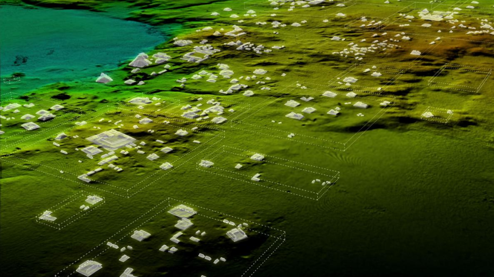
What looks to the naked eye like any other jungle canopy is revealed via LiDAR and augmented reality software as ancient Mayan structures.

Image courtesy of Wild Blue Media/National Geographic
The study by the PACUNAM Foundation not only suggests that Mayan populations were bigger than first thought (and as originally revealed by ground-based research), but disputes prior thinking that civilizations couldn’t exist, let alone thrive, in dense tropical areas.

Image courtesy of Wild Blue Media/National Geographic
The discovery shows that the cities were connected via elevated causeways suggesting trade and other interaction took place across the “megalopolis” – even during rainy seasons. In fact, the flow of water was controlled via sophisticated canals, dikes and reservoirs.

Image courtesy of Wild Blue Media/National Geographic
What is LiDAR?
LiDAR uses light waves to collect data and provide 3D information for an area of interest or a project area. Wavelengths are measured as they bounce back, much like how whales and bats use sonar to hunt and navigate. Use cases for LiDAR include surface and vegetation mapping, transportation corridor mapping, transmission route mapping and 3D building mapping. It’s even being used to prevent driverless cars crash into objects. Once captured, the measurements are used to produce a highly detailed 3D image of the ground surface topography.
LiDAR plus Reality Capture Speeds Deliverables
The big advantage of LiDAR is time-savings. Conventional topographic surveys take time, while inputting this data in design programs can take even longer. This means, as a designer, you don’t always have the clearest picture of your project’s reality.
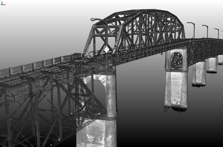
Using LiDAR, however, you can capture spatial information about the physical environment of your project through photography, laser scanning, existing geospatial and survey data, and more. Then you can integrate this data about existing conditions into the design model. A point cloud provides detailed ground-surface measurements, as well as accurate representations of assets like lamp posts, storm drains, curbs, signs, overpass and underpass clearance and complexity, and surrounding vegetation.
LiDAR Scanning has been around for a long time. But, as Shawn Herring, writes in the Autodesk Knowledge Network, one of the biggest issues is the deliverable of billions of points and the time and cost associated with modeling the point cloud so you can get it out of your software as quick as possible. “That typically necessitates a non-Autodesk product and can get pretty expensive.” However, with the addition of reality capture software, such as ReCap from Autodesk, to infrastructure tools from Autodesk, such as Civil 3D, “…these billions of points seem to act like nothing more than a typical AutoCAD entity, making it much easier on you and your computer to handle.” With ReCap you can convert the data points gathered with LiDAR into a 3D model or 2D drawing without the time and cost associated with modeling a point cloud.
Below is an example of a point cloud of Manette Bridge, Washington, courtesy of Washington State Department of Transportation.

Read More About LiDAR
How Government Agencies are Using LiDAR to Cut Costs Across Hundreds of Use Cases
How NYC Officials Are Using LiDAR to Prepare for Future Storms
Featured image courtesy of Wild Blue Media/National Geographic


